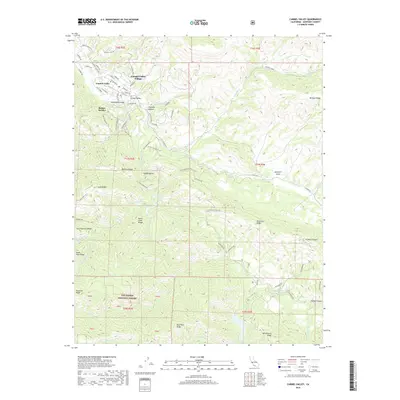
2018 Map of Carmel Valley
USGS Topo · Published 2018About this map
Carmel Valley Village and the adjacent community of Robles Del Rio serve as the primary residential hubs along the winding course of the Carmel River. The landscape is defined by the dramatic transitions between the valley floor and the steep heights of the Santa Lucia Range, where numerous lateral canyons like Klondike Canyon and Hitchcock Canyon feed into the main drainage.
Find a feature on this map
76 named features on this map. Tap any name to fly to it.
Don’t see what you’re looking for? This feature index may not catch every label — zoom into the map to look around manually.
Map Details
Editions of this 2018 Carmel Valley Map
This is the sole edition of this map. No revisions or reprints were ever made.
Other maps of this area

1910 · Salinas
USGS Topo · 1:31,680

1912 · Salinas
USGS Topo · 1:62,500

1913 · Monterey
USGS Topo · 1:62,500

1918 · Point Sur
USGS Topo · 1:62,500

1920 · Jamesburg
USGS Topo · 1:48,000

1921 · Jamesburg
USGS Topo · 1:62,500

1925 · Point Sur
USGS Topo · 1:62,500

1939 · Jamesburg
USGS Topo · 1:62,500

1940 · Salinas
USGS Topo · 1:62,500

1940 · Jamesburg
USGS Topo · 1:62,500