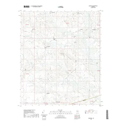
2018 Map of Carmichael
USGS Topo · Published 2018About this map
The rural landscapes of eastern Mississippi near the Alabama border are defined by a network of creek drainages and small, scattered settlements. Carmichael and Langsdale anchor the central and southern portions of this terrain, where the topography is carved by the Buckatunna Creek and its many tributaries, including Bolingchessa Cr and Hanging Moss Cr. The map reveals a high density of small family and community burial grounds, such as Andrews Chapel Cem, White Liberty Cem, and the Bass Everett Cem, which provide significant points of interest for genealogists and local historians. This 2018 survey shows a region largely preserved in its traditional rural layout, with travel centered around a complex of county roads like Co RD 630 and Co RD 610. Notable crossings like Theads Bridge and Evans Bridge mark the historical transit points over the winding waterways that have long dictated the movement and settlement patterns of this corner of Clarke County.
Find a feature on this map
77 named features on this map. Tap any name to fly to it.
Don’t see what you’re looking for? This feature index may not catch every label — zoom into the map to look around manually.
Map Details
Editions of this 2018 Carmichael Map
This is the sole edition of this map. No revisions or reprints were ever made.
Other maps of this area

1953 · Hattiesburg
USGS Topo · 1:250,000

1953 · Meridian
USGS Topo · 1:250,000

1957 · Meridian
USGS Topo · 1:250,000

1957 · Quitman
USGS Topo · 1:62,500

1958 · Hattiesburg
USGS Topo · 1:250,000

1964 · Carmichael
USGS Topo · 1:24,000

1964 · De Soto
USGS Topo · 1:24,000

1964 · Shubuta
USGS Topo · 1:24,000

1964 · Matherville
USGS Topo · 1:24,000

1965 · Meridian
USGS Topo · 1:250,000