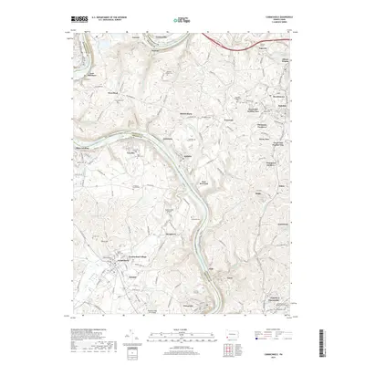
2019 Map of Carmichaels
USGS Topo · Published 2019About this map
The Monongahela River winds through the heart of this landscape, separating the borderlands of Washington, Fayette, and Greene Counties. The river valley is a hub of industrial-era settlements and small communities, including Crucible, Isabella, and Rices Landing. Away from the water, the terrain is dotted with ancestral burial grounds such as Greene Academy Cem, Saint Marys Cem, and the Cromwell Family Cem.
Find a feature on this map
144 named features on this map. Tap any name to fly to it.
Don’t see what you’re looking for? This feature index may not catch every label — zoom into the map to look around manually.
Map Details
Editions of this 2019 Carmichaels Map
This is the sole edition of this map. No revisions or reprints were ever made.
Other maps of this area

1900 · Masontown
USGS Topo · 1:62,500

1901 · Amity
USGS Topo · 1:62,500

1901 · Waynesburg
USGS Topo · 1:62,500

1902 · Brownsville
USGS Topo · 1:62,500

1903 · Masontown
USGS Topo · 1:62,500

1904 · Amity
USGS Topo · 1:62,500

1904 · Waynesburg
USGS Topo · 1:62,500

1906 · Brownsville
USGS Topo · 1:62,500

1931 · Brownsville
USGS Topo · 1:62,500

1931 · Masontown
USGS Topo · 1:62,500