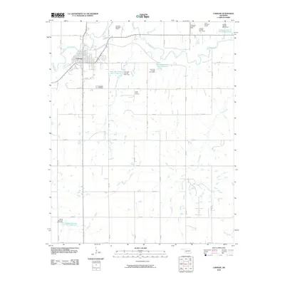
2010 Map of Carnegie
USGS Topo · Published 2010About this map
The Washita River meanders through the northern plains of Caddo County, anchoring the town of Carnegie in a landscape defined by an extensive water management system. By 2010, the region’s topography had been significantly influenced by numerous dams and reservoirs, such as the Saddle Mountain Site 3 Reservoir and Fort Cobb Laterals Site 1 Reservoir, which reflect the area's agricultural reliance on controlled water flow. The map documents a rural infrastructure where grid-like county roads connect isolated landmarks. Local history is anchored at the Carnegie Cemetery and the more remote Cedar Creek Cemetery. Transportation is notably represented by several small-scale aviation sites, including the Carnegie Municipal Airport and the Lawrence Landing Strip, illustrating the importance of light aircraft in this expansive landscape.
Find a feature on this map
36 named features on this map. Tap any name to fly to it.
Don’t see what you’re looking for? This feature index may not catch every label — zoom into the map to look around manually.
Map Details
Editions of this 2010 Carnegie Map
This is the sole edition of this map. No revisions or reprints were ever made.
Other maps of this area

1950 · Saddle Mountain
USGS Topo · 1:62,500

1951 · Fort Cobb
USGS Topo · 1:62,500

1955 · Lawton
USGS Topo · 1:250,000

1955 · Clinton
USGS Topo · 1:250,000

1956 · Alden
USGS Topo · 1:24,000

1956 · Boone
USGS Topo · 1:24,000

1956 · Bally Mountain
USGS Topo · 1:24,000

1956 · Apache
USGS Topo · 1:62,500

1956 · Saddle Mountain
USGS Topo · 1:62,500

1957 · Clinton
USGS Topo · 1:250,000