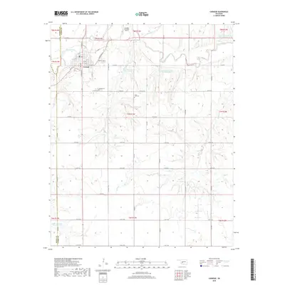
2018 Map of Carnegie
USGS Topo · Published 2018About this map
The town of Carnegie serves as the central hub of this Caddo County landscape, positioned just south of the Washita River. The community’s grid extends from W 4th St and S Carnegie St, anchored by local landmarks like the Carnegie Municipal Airport and Carnegie Cem. Beyond the town center, the terrain is defined by a dense network of sectional roads and a sophisticated water management system. Numerous reservoirs, including the Fort Cobb Laterals Site 1 Reservoir and Fort Cobb Laterals Site 2 Reservoir, are strategically placed along tributaries such as Cedar Cr and Gokey Cr. These features reflect the region's reliance on managed water resources for its agrarian economy. Genealogists and local historians can find site-specific details at the Cedar Creek Cem, while tracing the boundary lines between Washita, Kiowa, and Caddo counties in the surrounding rural townships.
Find a feature on this map
44 named features on this map. Tap any name to fly to it.
Don’t see what you’re looking for? This feature index may not catch every label — zoom into the map to look around manually.
Map Details
Editions of this 2018 Carnegie Map
This is the sole edition of this map. No revisions or reprints were ever made.
Other maps of this area

1950 · Saddle Mountain
USGS Topo · 1:62,500

1951 · Fort Cobb
USGS Topo · 1:62,500

1955 · Lawton
USGS Topo · 1:250,000

1955 · Clinton
USGS Topo · 1:250,000

1956 · Alden
USGS Topo · 1:24,000

1956 · Boone
USGS Topo · 1:24,000

1956 · Bally Mountain
USGS Topo · 1:24,000

1956 · Apache
USGS Topo · 1:62,500

1956 · Saddle Mountain
USGS Topo · 1:62,500

1957 · Clinton
USGS Topo · 1:250,000