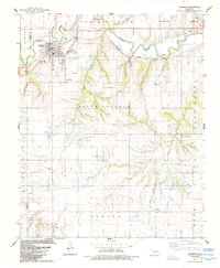
1984 Map of Carnegie
USGS Topo · Published 1985About this map
The Washita River meanders through the northern section of this territory, where the town of Carnegie serves as a local hub at the intersection of the C R I & P railroad and regional roadways. This mid-1980s landscape is defined by its agricultural and energy infrastructure, featuring an Oil Field in the southwest and a network of named drainages including North Running Lathram Creek and South Lathram Creek.
Find a feature on this map
30 named features on this map. Tap any name to fly to it.
Don’t see what you’re looking for? This feature index may not catch every label — zoom into the map to look around manually.
Map Details
Editions of this 1984 Carnegie Map
This is the sole edition of this map. No revisions or reprints were ever made.
Other maps of this area

1950 · Saddle Mountain
USGS Topo · 1:62,500

1951 · Fort Cobb
USGS Topo · 1:62,500

1955 · Lawton
USGS Topo · 1:250,000

1955 · Clinton
USGS Topo · 1:250,000

1956 · Alden
USGS Topo · 1:24,000

1956 · Boone
USGS Topo · 1:24,000

1956 · Bally Mountain
USGS Topo · 1:24,000

1956 · Apache
USGS Topo · 1:62,500

1956 · Saddle Mountain
USGS Topo · 1:62,500

1957 · Clinton
USGS Topo · 1:250,000