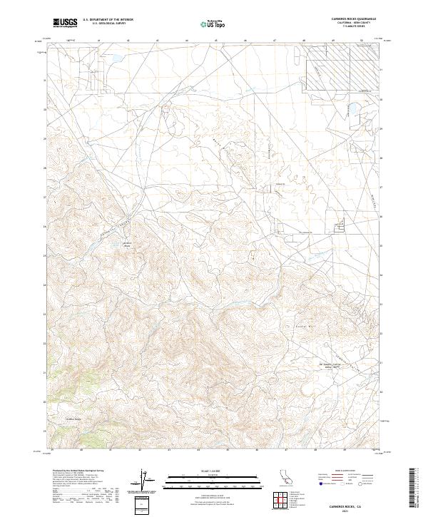
2021 Map of Carneros Rocks
USGS Topo · Published 2021About this map
Carneros Rocks stand as a prominent geologic landmark within this landscape of western Kern County, where the Temblor Range meets the edge of the San Joaquin Valley. The terrain is defined by a series of seasonal drainages and canyons, including the significant Carneros Canyon and the winding course of Chico Martinez Cr. Water sources like Carneros Spring are vital features in this arid environment, historically serving as critical waypoints for local travel and ranching operations. The area is marked by a network of ranch and resource roads such as 7th Standard Rd and Temblor Rd, which navigate the elevation changes between the Bacon Hills and Gould Hill. This survey illustrates the intricate Public Land Survey System grid that continues to govern land division and resource management in this corner of the California foothills.
Find a feature on this map
27 named features on this map. Tap any name to fly to it.
Don’t see what you’re looking for? This feature index may not catch every label — zoom into the map to look around manually.
Map Details
Editions of this 2021 Carneros Rocks Map
This is the sole edition of this map. No revisions or reprints were ever made.
Other maps of this area

1912 · McKittrick
USGS Topo · 1:125,000

1914 · Lost Hills
USGS Topo · 1:125,000

1932 · West of Goose Lake
USGS Topo · 1:31,680

1934 · West of Goose Lake
USGS Topo · 1:31,680
1942 · Hart Station
USGS Topo · 1:62,500

1943 · Simmler
USGS Topo · 1:62,500
1943 · Belridge
USGS Topo · 1:31,680
1943 · Shale Point
USGS Topo · 1:31,680
1943 · Blackwell
USGS Topo · 1:31,680

1948 · Bakersfield
USGS Topo · 1:250,000