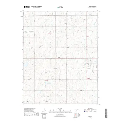
2018 Map of Carney
USGS Topo · Published 2018About this map
Carney serves as the central hub for this portion of Lincoln County, situated at the junction of Cimmaron Ave and Central Ave. The landscape is a network of section-line roads and creek drainages, including Bellcow Creek and Dugout Creek. Smaller historical settlements and rail-aligned points like Fallis, Dudley, and Emsey are scattered throughout the territory, marking the distribution of late 19th and early 20th-century development in the region.
Find a feature on this map
40 named features on this map. Tap any name to fly to it.
Don’t see what you’re looking for? This feature index may not catch every label — zoom into the map to look around manually.
Map Details
Editions of this 2018 Carney Map
This is the sole edition of this map. No revisions or reprints were ever made.
Other maps of this area

1905 · Chandler
USGS Topo · 1:62,500

1907 · Chandler
USGS Topo · 1:62,500

1908 · Agra
USGS Topo · 1:62,500

1909 · Luther
USGS Topo · 1:62,500

1909 · Perkins
USGS Topo · 1:62,500

1954 · Oklahoma City
USGS Topo · 1:250,000

1957 · Oklahoma City
USGS Topo · 1:250,000

1963 · Oklahoma City
USGS Topo · 1:250,000
1966 · Wellston
USGS Topo · 1:24,000
1966 · Luther
USGS Topo · 1:24,000