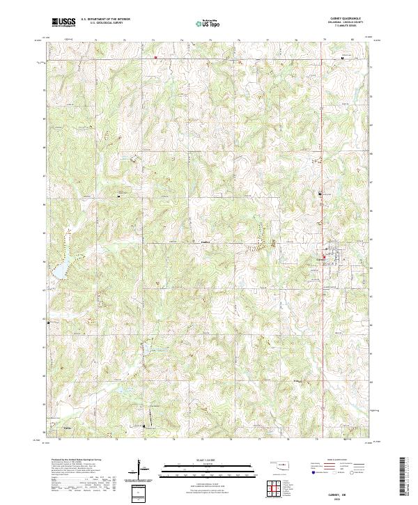
2022 Map of Carney
USGS Topo · Published 2022About this map
The town of Carney and the nearby village of Fallis anchor this Lincoln County landscape, where rural life is shaped by the drainages of Bellcow Cr and Headquarters Cr. The map reveals a high density of community markers, particularly through its cemeteries including Bethlehem Cem, Great Hope Cem, and Iowa Mission Cem, which suggest a deep-rooted genealogical history in the area. Evidence of mid-century infrastructure and energy development is clear through labels for Gas Plant Rd, Oil Field Rd, and several named reservoirs. Small rural hubs such as Dudley and Emsey remain identifiable along the grid of county roads, while Ives Airport serves as a modern local landmark near the southern edge of the quadrangle.
Find a feature on this map
43 named features on this map. Tap any name to fly to it.
Don’t see what you’re looking for? This feature index may not catch every label — zoom into the map to look around manually.
Map Details
Editions of this 2022 Carney Map
This is the sole edition of this map. No revisions or reprints were ever made.
Other maps of this area

1905 · Chandler
USGS Topo · 1:62,500

1907 · Chandler
USGS Topo · 1:62,500

1908 · Agra
USGS Topo · 1:62,500

1909 · Luther
USGS Topo · 1:62,500

1909 · Perkins
USGS Topo · 1:62,500

1954 · Oklahoma City
USGS Topo · 1:250,000

1957 · Oklahoma City
USGS Topo · 1:250,000

1963 · Oklahoma City
USGS Topo · 1:250,000
1966 · Wellston
USGS Topo · 1:24,000
1966 · Luther
USGS Topo · 1:24,000