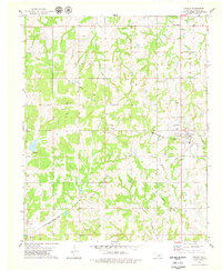
1978 Map of Carney
USGS Topo · Published 1979About this map
Carney serves as the focal point of this late 1970s survey, situated along the Missouri-Kansas-Texas railroad line in Lincoln County. The landscape is marked by a transition from traditional rail transport to modern energy infrastructure, with numerous Oil Wells and Gas Wells scattered across the township lines of Iowa and Tohee. Local history is deeply embedded in the rural landscape, preserved through family and community landmarks like Pollock Cem, Great Hope Cem, and Pilgrim Ch.
Find a feature on this map
25 named features on this map. Tap any name to fly to it.
Don’t see what you’re looking for? This feature index may not catch every label — zoom into the map to look around manually.
Map Details
Editions of this 1978 Carney Map
This is the sole edition of this map. No revisions or reprints were ever made.
Other maps of this area

1905 · Chandler
USGS Topo · 1:62,500

1907 · Chandler
USGS Topo · 1:62,500

1908 · Agra
USGS Topo · 1:62,500

1909 · Luther
USGS Topo · 1:62,500

1909 · Perkins
USGS Topo · 1:62,500

1954 · Oklahoma City
USGS Topo · 1:250,000

1957 · Oklahoma City
USGS Topo · 1:250,000

1963 · Oklahoma City
USGS Topo · 1:250,000
1966 · Wellston
USGS Topo · 1:24,000
1966 · Luther
USGS Topo · 1:24,000