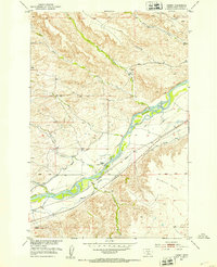
1951 Map of Carney
USGS Topo · Published 1953About this map
The Yellowstone River cuts a wide, braided path through this Sweet Grass County landscape, serving as the central artery for a complex irrigation network. Early 1950s water management is visible through numerous engineered waterways including the Hunters Hot Springs Canal, Westfall Ditch, and the Mayborn Praether Ditch. These systems supported agricultural efforts near the Northern Pacific railroad line, which follows the river's southern bank through the settlement of Carney.
Find a feature on this map
25 named features on this map. Tap any name to fly to it.
Don’t see what you’re looking for? This feature index may not catch every label — zoom into the map to look around manually.
Map Details
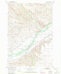
Editions of this 1951 Carney Map
2 editions found
Other maps of this area

1891 · Livingston
USGS Topo · 1:250,000

1891 · Big Timber
USGS Topo · 1:125,000

1893 · Livingston
USGS Topo · 1:250,000

1893 · Big Timber
USGS Topo · 1:125,000

1947 · Bozeman
USGS Topo · 1:250,000

1948 · Bozeman
USGS Topo · 1:250,000
1951 · Grosfield Ranch
USGS Topo · 1:24,000
1951 · Raspberry Butte
USGS Topo · 1:24,000

1951 · Kelly Hills
USGS Topo · 1:24,000

1951 · Springdale
USGS Topo · 1:24,000