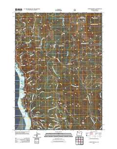
2011 Map of Carpenterville
USGS Topo · Published 2011About this map
Carpenterville sits along the high ridges of the Oregon coast, overlooking a complex landscape of deep gulches and rocky coastal features. This 2011 survey captures the area’s rugged interior, where peaks like Burnt Hill Summit and Fitzpatrick Ridge separate the drainages of the South Fork Pistol River and the North Fork Chetco River. Along the Pacific shoreline, significant landmarks like Whalehead Island and Seal Point define the maritime border. The interior is marked by upland clearings and traditional sites such as Mule Prairie, Rocky Prairie, and Joe Hostler Camp. The infrastructure of the Pacific Highway is anchored by the Thomas Creek Bridge, a critical crossing over the steep drainage of Thomas Creek. Local routes like Carpenterville Rd and Martin Ranch Rd provide access to the dispersed settlements and hills that have long shaped the transit and ranching history of this corner of Curry County.
Find a feature on this map
61 named features on this map. Tap any name to fly to it.
Don’t see what you’re looking for? This feature index may not catch every label — zoom into the map to look around manually.
Map Details
Editions of this 2011 Carpenterville Map
This is the sole edition of this map. No revisions or reprints were ever made.
Other maps of this area

1954 · Coos Bay
USGS Topo · 1:250,000

1954 · Cape Ferrelo
USGS Topo · 1:62,500

1954 · Gold Beach
USGS Topo · 1:62,500

1954 · Collier Butte
USGS Topo · 1:62,500

1954 · Mt. Emily
USGS Topo · 1:62,500

1958 · Coos Bay
USGS Topo · 1:250,000

1962 · Coos Bay
USGS Topo · 1:250,000
1985 · Mack Point
USGS Topo · 1:24,000
1986 · Carpenterville
USGS Topo · 1:24,000
1986 · Brookings
USGS Topo · 1:24,000