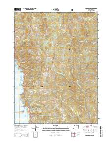
2014 Map of Carpenterville
USGS Topo · Published 2014About this map
The Pacific Ocean coastline dominates the western edge of this coastal survey, where the Oregon Coast Hwy winds past dramatic landforms including Natural Bridges and Whalehead Island. The landscape is defined by the sharp transition from sea level to the timbered heights of the Siskiyou National Forest. Inland, the settlement of Carpenterville sits along the Carpenterville Hwy, surrounded by a network of ridges and buttes like Fitzpatrick Ridge and Colegrove Butte.
Find a feature on this map
71 named features on this map. Tap any name to fly to it.
Don’t see what you’re looking for? This feature index may not catch every label — zoom into the map to look around manually.
Map Details
Editions of this 2014 Carpenterville Map
This is the sole edition of this map. No revisions or reprints were ever made.
Other maps of this area

1954 · Coos Bay
USGS Topo · 1:250,000

1954 · Cape Ferrelo
USGS Topo · 1:62,500

1954 · Gold Beach
USGS Topo · 1:62,500

1954 · Collier Butte
USGS Topo · 1:62,500

1954 · Mt. Emily
USGS Topo · 1:62,500

1958 · Coos Bay
USGS Topo · 1:250,000

1962 · Coos Bay
USGS Topo · 1:250,000
1985 · Mack Point
USGS Topo · 1:24,000
1986 · Carpenterville
USGS Topo · 1:24,000
1986 · Brookings
USGS Topo · 1:24,000