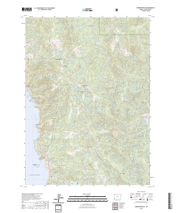
2024 Map of Carpenterville
USGS Topo · Published 2024About this map
Carpenterville sits atop the high coastal ridges of Curry County, where the southern Oregon shoreline meets the steep elevations of the Siskiyou National Forest. This contemporary survey details a landscape defined by dramatic transitions from the Pacific Ocean to inland summits like Burnt Hill Summit and Mt Italy. Along the jagged coast, the Oregon Islands National Wildlife Refuge and Oregon Islands Wilderness protect offshore features such as Whalehead Island and Seal Point.
Find a feature on this map
66 named features on this map. Tap any name to fly to it.
Don’t see what you’re looking for? This feature index may not catch every label — zoom into the map to look around manually.
Map Details
Editions of this 2024 Carpenterville Map
This is the sole edition of this map. No revisions or reprints were ever made.
Other maps of this area

1954 · Coos Bay
USGS Topo · 1:250,000

1954 · Cape Ferrelo
USGS Topo · 1:62,500

1954 · Gold Beach
USGS Topo · 1:62,500

1954 · Collier Butte
USGS Topo · 1:62,500

1954 · Mt. Emily
USGS Topo · 1:62,500

1958 · Coos Bay
USGS Topo · 1:250,000

1962 · Coos Bay
USGS Topo · 1:250,000
1985 · Mack Point
USGS Topo · 1:24,000
1986 · Carpenterville
USGS Topo · 1:24,000
1986 · Brookings
USGS Topo · 1:24,000