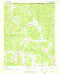
1963 Map of Carracas Canyon
USGS Topo · Published 1972About this map
Carracas Canyon and the surrounding high country of northern New Mexico are documented here during a period of transition in land management. The intersection of the Jicarilla Apache Indian Reservation and the Carson National Forest creates a landscape of deep canyons and prominent ridges, such as Estufa Ridge and Carracas Mesa. The settlement of Carracas sits in the northwest corner, complete with a local Cem, while Los Cuates marks the central basin area.
Find a feature on this map
43 named features on this map. Tap any name to fly to it.
Don’t see what you’re looking for? This feature index may not catch every label — zoom into the map to look around manually.
Map Details
Editions of this 1963 Carracas Canyon Map
3 editions found
Other maps of this area

1889 · Largo
USGS Topo · 1:250,000

1895 · Largo
USGS Topo · 1:250,000

1924 · Pagosa Springs
USGS Topo · 1:125,000

1927 · Pagosa Springs
USGS Topo · 1:125,000

1945 · Durango
USGS Topo · 1:250,000

1953 · Durango
USGS Topo · 1:250,000

1954 · Durango
USGS Topo · 1:250,000

1954 · Carracas
USGS Topo · 1:24,000

1954 · Aztec
USGS Topo · 1:250,000

1957 · Pagosa Junction
USGS Topo · 1:62,500