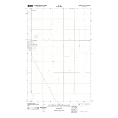
2011 Map of Carrington East
USGS Topo · Published 2011About this map
Carrington anchors the northwestern corner of this landscape, its residential grid of avenues and streets representing the primary urban concentration amidst the surrounding Foster County prairie. The map details the transition from the city center near Main St and 1st St Ne to the rural outskirts, where a rigid section-line road network takes over. This geometry is defined by long, straight corridors such as 72nd Ave Ne and 70th Ave Se, which parcel the land for agricultural use. North of the town center, the Carrington Water Works stands as a notable infrastructure landmark along the primary north-south highway corridor. South of the city's heart, newer residential development is visible along Joal Dr, illustrating the gradual expansion of the settlement into the neighboring plains during the early twenty-first century.
Find a feature on this map
32 named features on this map. Tap any name to fly to it.
Don’t see what you’re looking for? This feature index may not catch every label — zoom into the map to look around manually.
Map Details
Editions of this 2011 Carrington East Map
This is the sole edition of this map. No revisions or reprints were ever made.
Other maps of this area

1900 · Pingree
USGS Topo · 1:125,000

1944 · Brantford
USGS Topo · 1:62,500

1946 · Brantford
USGS Topo · 1:62,500

1948 · New Rockford
USGS Topo · 1:62,500

1948 · Carrington
USGS Topo · 1:62,500

1950 · Carrington East
USGS Topo · 1:24,000

1950 · Melville
USGS Topo · 1:24,000

1950 · Brantford
USGS Topo · 1:24,000
1950 · New Rockford SE
USGS Topo · 1:24,000

1950 · Barlow
USGS Topo · 1:24,000