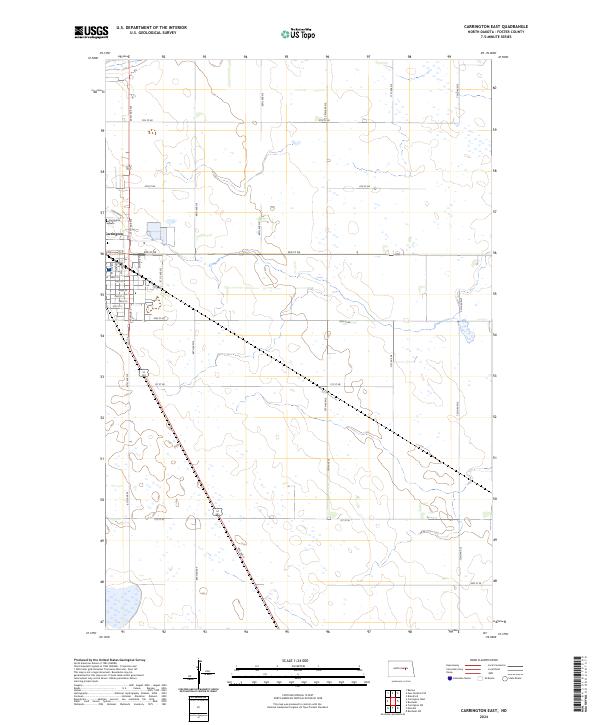
2024 Map of Carrington East
USGS Topo · Published 2024About this map
Carrington occupies the western edge of this landscape, where the street grid of the eastern town limits transitions into the agricultural expanse of Foster County. The town layout is clearly defined by historical thoroughfares such as Main St and 8th Ave N, while the Carrington Cem stands on the northwestern outskirts. Beyond the residential and commercial corridors, the terrain is characterized by the numerous wetlands and depressions of the prairie pothole region, several of which are protected within the Foster County Waterfowl Production Area. This conservation land appears in multiple tracts, highlighting the area's importance for migratory birds and local ecology. The map also traces the intersection of major regional routes like 4th Ave S, which cuts diagonally across the southern sections, anchoring the local transportation network between the cultivated fields.
Find a feature on this map
34 named features on this map. Tap any name to fly to it.
Don’t see what you’re looking for? This feature index may not catch every label — zoom into the map to look around manually.
Map Details
Editions of this 2024 Carrington East Map
This is the sole edition of this map. No revisions or reprints were ever made.
Other maps of this area

1900 · Pingree
USGS Topo · 1:125,000

1944 · Brantford
USGS Topo · 1:62,500

1946 · Brantford
USGS Topo · 1:62,500

1948 · New Rockford
USGS Topo · 1:62,500

1948 · Carrington
USGS Topo · 1:62,500

1950 · Carrington East
USGS Topo · 1:24,000

1950 · Melville
USGS Topo · 1:24,000

1950 · Brantford
USGS Topo · 1:24,000
1950 · New Rockford SE
USGS Topo · 1:24,000

1950 · Barlow
USGS Topo · 1:24,000