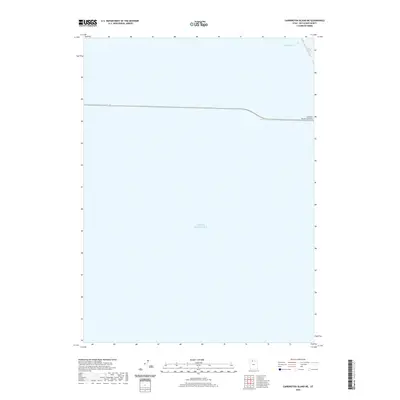
2020 Map of Carrington Island NE
USGS Topo · Published 2020About this map
The vast expanse of the Great Salt Lake dominates this 2020 survey, revealing the critical transportation infrastructure that cuts across the water in northern Utah. The most prominent human feature is the Southern Pacific Causeway, a massive engineering feat that serves as a terrestrial link across the briny landscape of Box Elder County. This corridor has long been a vital artery for transcontinental rail traffic, replacing the original wooden trestle with a solid rock-fill structure that effectively divides the lake into distinct northern and southern arms. Near the northeastern edge of the sheet, the presence of a Ship Channel indicates the specialized navigation required for industrial or research vessels operating within these mineral-rich waters. The map illustrates the stark contrast between the open water and the narrow, man-made land bridge that facilitates movement through this unique environment.
Find a feature on this map
3 named features on this map. Tap any name to fly to it.
Don’t see what you’re looking for? This feature index may not catch every label — zoom into the map to look around manually.
Map Details
Editions of this 2020 Carrington Island NE Map
This is the sole edition of this map. No revisions or reprints were ever made.
Other maps of this area

1954 · Brigham City
USGS Topo · 1:250,000

1958 · Brigham City
USGS Topo · 1:250,000

1962 · Brigham City
USGS Topo · 1:250,000

1968 · Indian Cove
USGS Topo · 1:24,000

1968 · Pokes Point
USGS Topo · 1:24,000

1968 · Promontory Point
USGS Topo · 1:24,000

1968 · Carrington Island SW
USGS Topo · 1:24,000

1968 · Fremont Island SW
USGS Topo · 1:24,000

1968 · Carrington Island
USGS Topo · 1:24,000

1969 · Rozel Point SW
USGS Topo · 1:24,000