
1969 Map of Rozel Point SW
USGS Topo · Published 1971About this map
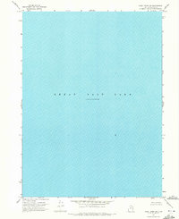
Great Salt Lake dominates this 1969 hydrographic study, providing a rare technical look at the northern reaches of this saline landscape during a specific moment in the mid-1960s. Unlike standard topographic sheets, this map focuses on the water and the lakebed, recording an Elevation 4193 November 1966 benchmark. The data was synthesized from diverse sources, including soundings from the U.S. Naval Reserve and information from the Utah Geological and Mineralogical Survey, illustrating the collaborative effort to track the shifting boundaries of the lake.
Find a feature on this map
2 named features on this map. Tap any name to fly to it.
Don’t see what you’re looking for? This feature index may not catch every label — zoom into the map to look around manually.
Map Details
Editions of this 1969 Rozel Point SW Map
2 editions found
Other maps of this area

1954 · Brigham City
USGS Topo · 1:250,000

1958 · Brigham City
USGS Topo · 1:250,000

1962 · Brigham City
USGS Topo · 1:250,000

1968 · Messix Peak
USGS Topo · 1:24,000

1968 · Indian Cove
USGS Topo · 1:24,000

1968 · Rozel Point
USGS Topo · 1:24,000

1969 · Carrington Island NW
USGS Topo · 1:24,000

1969 · Gunnison Island
USGS Topo · 1:24,000
1969 · Gunnison Island NE
USGS Topo · 1:24,000
1969 · Carrington Island NE
USGS Topo · 1:24,000