
1969 Map of Gunnison Island
USGS Topo · Published 1972About this map
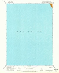
Great Salt Lake dominates the eastern half of this orthophotomap, showing the water level at an elevation of 4,193 feet as recorded in late 1966. To the west, the landscape is defined by a wide Mud Flat that separates the open water from the more stable terrain of the shoreline. The most prominent topographical features are Gunnison Island and its smaller neighbor, Cub Island, which rise out of the lake's northern reaches. This 1969 field-checked survey uses an orthophotomosaic to provide a realistic visual representation of the salt-crusted flats and the shallow bathymetry of the lake bed, based on soundings provided by the U.S. Naval Reserve and the U. S. Corps of Engineers.
Find a feature on this map
5 named features on this map. Tap any name to fly to it.
Don’t see what you’re looking for? This feature index may not catch every label — zoom into the map to look around manually.
Map Details
Editions of this 1969 Gunnison Island Map
This is the sole edition of this map. No revisions or reprints were ever made.
Other maps of this area

1954 · Brigham City
USGS Topo · 1:250,000

1958 · Brigham City
USGS Topo · 1:250,000

1962 · Brigham City
USGS Topo · 1:250,000

1968 · Rozel Point
USGS Topo · 1:24,000

1969 · Rozel Point SW
USGS Topo · 1:24,000

1969 · Gunnison Island SW
USGS Topo · 1:24,000

1969 · Carrington Island NW
USGS Topo · 1:24,000

1969 · Strongs Knob
USGS Topo · 1:24,000
1969 · Gunnison Island NE
USGS Topo · 1:24,000
1969 · Dolphin Island East
USGS Topo · 1:24,000