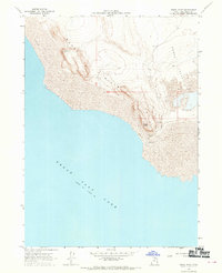
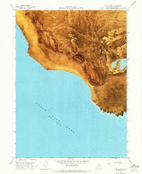
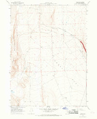
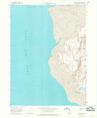
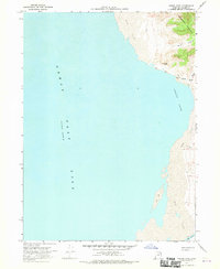
1968 Map of Rozel Point
USGS Topo · Published 1970About this map
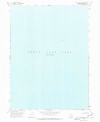
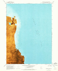
Rozel Point Oil Field sits at the southern tip of a distinctive peninsula where the Rozel Hills meet the northern reaches of the Great Salt Lake. This 1968 field-checked survey documents a landscape defined by the shifting interface of water and earth, dominated by an extensive Mud Flat and the adjacent Rozel Flat. The presence of a Seep and an Airway Beacon atop the ridges highlights the remote industrial and navigational utility of this Box Elder County coastline during the late 1960s. The map records the lake's elevation at 4,193 feet as of November 1966, providing a specific hydrological benchmark for the area surrounding Rozel Point before subsequent lake level fluctuations altered the shoreline.
Find a feature on this map
10 named features on this map. Tap any name to fly to it.
Don’t see what you’re looking for? This feature index may not catch every label — zoom into the map to look around manually.
Map Details
Editions of this 1968 Rozel Point Map
2 editions found
Other maps of this area

1954 · Brigham City
USGS Topo · 1:250,000

1958 · Brigham City
USGS Topo · 1:250,000

1962 · Brigham City
USGS Topo · 1:250,000
1967 · Golden Spike Monument
USGS Topo · 1:24,000
1968 · Messix Peak
USGS Topo · 1:24,000
1968 · Rozel
USGS Topo · 1:24,000
1968 · Coyote Point
USGS Topo · 1:24,000
1968 · Indian Cove
USGS Topo · 1:24,000
1969 · Rozel Point SW
USGS Topo · 1:24,000
1969 · Gunnison Island
USGS Topo · 1:24,000