
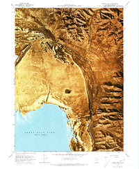
1968 Map of Messix Peak
USGS Topo · Published 1969About this map
The northern reaches of the Great Salt Lake define this late-1960s landscape, where the salt water meets the expansive silts of Mud Flat. To the west, Rozel Flat transitions into these lowlands, while the eastern edge of the quadrangle is dominated by the steep rise of the Promontory Mountains. Significant high points like Mt Tarpey and Messix Peak provide a dramatic contrast to the level basin floor, which sits just above 4,200 feet in elevation.
Find a feature on this map
16 named features on this map. Tap any name to fly to it.
Don’t see what you’re looking for? This feature index may not catch every label — zoom into the map to look around manually.
Map Details
Editions of this 1968 Messix Peak Map
2 editions found
Other maps of this area

1954 · Brigham City
USGS Topo · 1:250,000

1958 · Brigham City
USGS Topo · 1:250,000

1961 · Thatcher Mountain
USGS Topo · 1:62,500

1962 · Brigham City
USGS Topo · 1:250,000

1966 · Thatcher Mountain SW
USGS Topo · 1:24,000

1967 · Golden Spike Monument
USGS Topo · 1:24,000

1967 · East Promontory
USGS Topo · 1:24,000

1968 · Rozel
USGS Topo · 1:24,000

1968 · Indian Cove
USGS Topo · 1:24,000

1968 · Pokes Point
USGS Topo · 1:24,000