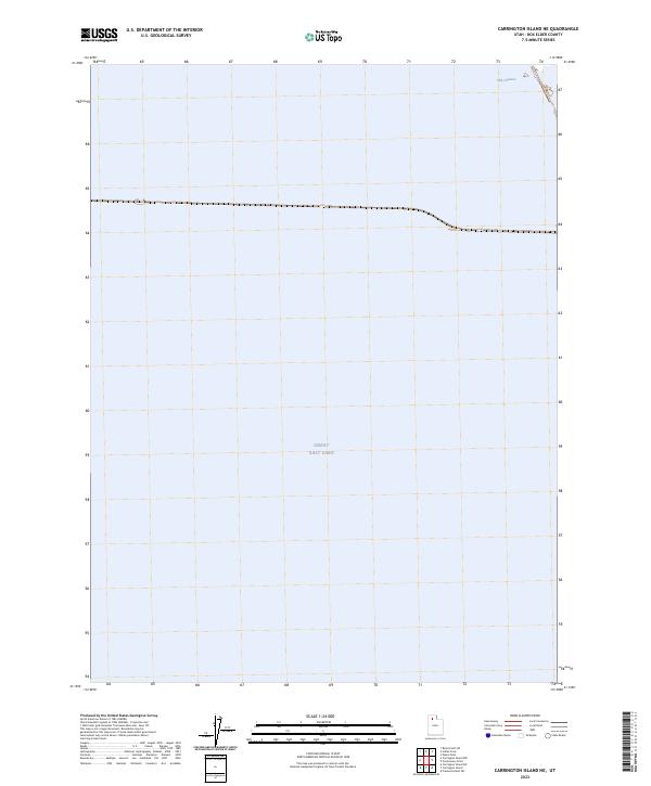
2023 Map of Carrington Island NE
USGS Topo · Published 2023About this map
Great Salt Lake dominates this northern Utah landscape, covering nearly the entire quadrangle in an expanse of salt water. In the northeast corner, a narrow, engineered Ship Channel provides a navigable path through the shallow waters, tracing the edge of what appears to be a causeway or embankment. The minimal topographical variation and sparse labeling reflect the unique environment of the lake bed in Box Elder County, where the transition between water and land is subtle and governed by fluctuating water levels. This 2023 edition captures the contemporary shoreline and drainage patterns as recorded by the U.S. Geological Survey and the National Hydrography Dataset.
Find a feature on this map
2 named features on this map. Tap any name to fly to it.
Don’t see what you’re looking for? This feature index may not catch every label — zoom into the map to look around manually.
Map Details
Editions of this 2023 Carrington Island NE Map
This is the sole edition of this map. No revisions or reprints were ever made.
Other maps of this area

1954 · Brigham City
USGS Topo · 1:250,000

1958 · Brigham City
USGS Topo · 1:250,000

1962 · Brigham City
USGS Topo · 1:250,000

1968 · Indian Cove
USGS Topo · 1:24,000

1968 · Pokes Point
USGS Topo · 1:24,000

1968 · Promontory Point
USGS Topo · 1:24,000

1968 · Carrington Island SW
USGS Topo · 1:24,000

1968 · Fremont Island SW
USGS Topo · 1:24,000

1968 · Carrington Island
USGS Topo · 1:24,000

1969 · Rozel Point SW
USGS Topo · 1:24,000