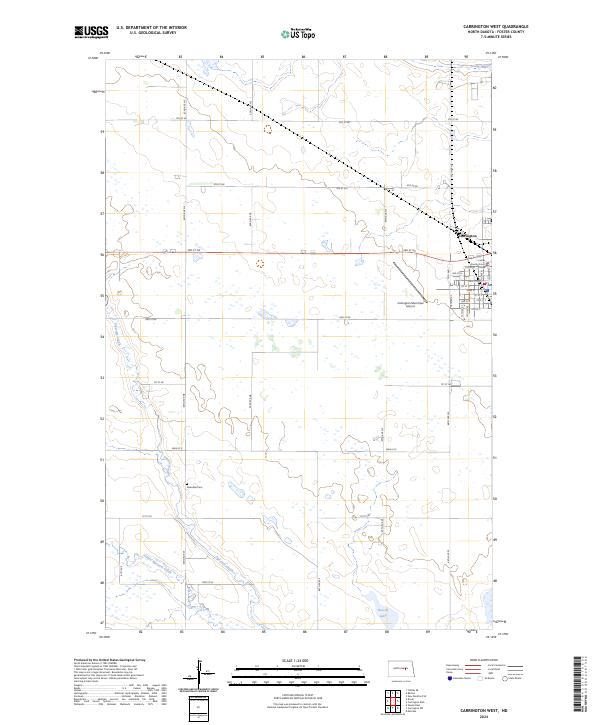
2024 Map of Carrington West
USGS Topo · Published 2024About this map
Carrington anchors this Foster County landscape, showing the transition from the city’s gridded streets to the expansive prairie wetlands of central North Dakota. The Foster County Court House stands as a local landmark within the town, which is served by the Carrington Municipal Airport to the south. The surrounding terrain is defined by the meandering courses of Pipestem Creek and Little Pipestem Creek, which flow through a region characterized by numerous small glacial depressions and sloughs, such as Scotts Slough. For those tracing local heritage, the Riverdale Cem provides a specific point of reference in the rural township south of the city. Conservation efforts are evident in the Foster County Waterfowl Production Area near Russell Lake, highlighting the area's importance as a habitat within the prairie pothole region.
Find a feature on this map
30 named features on this map. Tap any name to fly to it.
Don’t see what you’re looking for? This feature index may not catch every label — zoom into the map to look around manually.
Map Details
Editions of this 2024 Carrington West Map
This is the sole edition of this map. No revisions or reprints were ever made.
Other maps of this area

1948 · New Rockford
USGS Topo · 1:62,500

1948 · Cathay
USGS Topo · 1:62,500

1948 · Carrington
USGS Topo · 1:62,500

1949 · Cathay SE
USGS Topo · 1:24,000

1950 · Carrington East
USGS Topo · 1:24,000

1950 · Melville
USGS Topo · 1:24,000
1950 · New Rockford SE
USGS Topo · 1:24,000

1950 · Barlow
USGS Topo · 1:24,000

1950 · Carrington SW
USGS Topo · 1:24,000

1950 · Carrington West
USGS Topo · 1:24,000