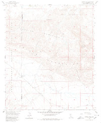
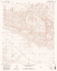
1957 Map of Carrizo Mtn
USGS Topo · Published 1980About this map
Anza-Borrego Desert State Park encompasses a significant portion of this arid landscape, where the San Diego and Imperial County line cuts through the western terrain. The geography is defined by the sharp transition between the Carrizo Badlands and the rising slopes of the Coyote Mountains, which culminate at Carrizo Mtn. This mid-century survey documents a specialized military presence in the northeast via the Carrizo Impact Area Naval Reservation, a site distinct from the surrounding conservation lands.
Find a feature on this map
16 named features on this map. Tap any name to fly to it.
Don’t see what you’re looking for? This feature index may not catch every label — zoom into the map to look around manually.
Map Details
Editions of this 1957 Carrizo Mtn Map
5 editions found
Other maps of this area

1915 · El Centro
USGS Topo · 1:125,000

1931 · Carrizo
USGS Topo · 1:125,000

1939 · Jacumba
USGS Topo · 1:62,500

1940 · Plaster City
USGS Topo · 1:62,500

1940 · Coyote Wells
USGS Topo · 1:62,500

1942 · El Centro
USGS Topo · 1:250,000

1942 · Carrizo Mtn
USGS Topo · 1:62,500

1942 · Jacumba
USGS Topo · 1:62,500

1943 · Coyote Wells
USGS Topo · 1:62,500

1944 · Plaster City
USGS Topo · 1:62,500