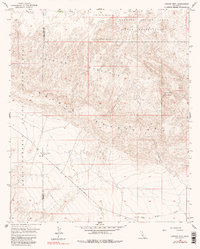
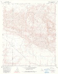
1957 Map of Carrizo Mtn
USGS Topo · Published 1990About this map
Anza-Borrego Desert State Park occupies the western portion of this 1957 survey, where the rugged topography of the Carrizo Mountains meets the stark Carrizo Badlands. This arid landscape is defined by its complex drainage systems, including Fossil Canyon and Carrizo Creek, which reveal the erosive forces shaping the Imperial County desert. The map captures a moment when the northern sector was designated as the Carrizo Impact Area Naval Reservation, highlighting the military's use of remote desert terrain for training during the mid-20th century.
Find a feature on this map
16 named features on this map. Tap any name to fly to it.
Don’t see what you’re looking for? This feature index may not catch every label — zoom into the map to look around manually.
Map Details
Editions of this 1957 Carrizo Mtn Map
5 editions found
Other maps of this area

1915 · El Centro
USGS Topo · 1:125,000

1931 · Carrizo
USGS Topo · 1:125,000

1939 · Jacumba
USGS Topo · 1:62,500

1940 · Plaster City
USGS Topo · 1:62,500

1940 · Coyote Wells
USGS Topo · 1:62,500

1942 · El Centro
USGS Topo · 1:250,000

1942 · Carrizo Mtn
USGS Topo · 1:62,500

1942 · Jacumba
USGS Topo · 1:62,500

1943 · Coyote Wells
USGS Topo · 1:62,500

1944 · Plaster City
USGS Topo · 1:62,500