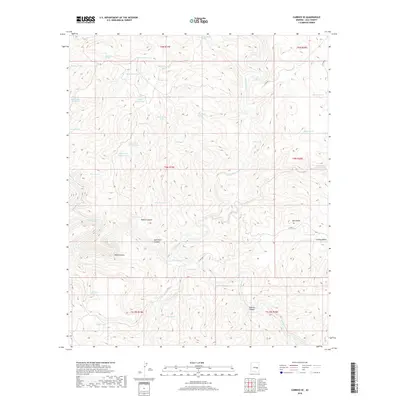
2018 Map of Carrizo SE
USGS Topo · Published 2018About this map
The confluence of Carrizo Creek and the Salt River dominates this Gila County landscape, where deep incisions like the Salt River Canyon define the topography. This 2018 survey documents a region defined by complex drainage systems and isolated water sources essential for land management. The presence of numerous named catchment features, such as Bill Schroeder Tank, John Moore Tank, and Bonehead Tank, suggests a landscape utilized for ranching or wildlife management where water security is paramount.
Find a feature on this map
48 named features on this map. Tap any name to fly to it.
Don’t see what you’re looking for? This feature index may not catch every label — zoom into the map to look around manually.
Map Details
Editions of this 2018 Carrizo SE Map
This is the sole edition of this map. No revisions or reprints were ever made.
Other maps of this area

1954 · Mesa
USGS Topo · 1:250,000

1957 · Mesa
USGS Topo · 1:250,000

1958 · Mesa
USGS Topo · 1:250,000

1960 · Mesa
USGS Topo · 1:250,000

1964 · Mesa
USGS Topo · 1:250,000

1966 · Brushy Canyon
USGS Topo · 1:24,000

1966 · Popcorn Canyon
USGS Topo · 1:24,000
1966 · Forks Butte
USGS Topo · 1:24,000
1966 · Carrizo
USGS Topo · 1:24,000
1966 · Cone Butte
USGS Topo · 1:24,000