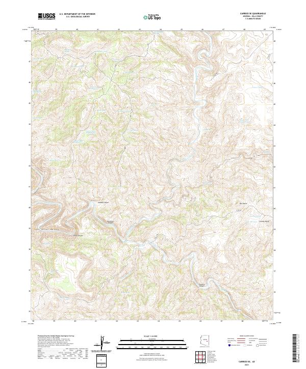
2021 Map of Carrizo SE
USGS Topo · Published 2021About this map
The Salt River Canyon dominates this landscape in central Arizona, where the Salt River carves through deep geological formations. The terrain is defined by a dense network of seasonal water sources and landmarks including Bull Butte and Cowboy Butte. A complex system of livestock-related infrastructure is evident through numerous named catchments such as Skeleton Tank, Louse Tank Number One, and Mine Tank Number Two.
Find a feature on this map
49 named features on this map. Tap any name to fly to it.
Don’t see what you’re looking for? This feature index may not catch every label — zoom into the map to look around manually.
Map Details
Editions of this 2021 Carrizo SE Map
This is the sole edition of this map. No revisions or reprints were ever made.
Other maps of this area

1954 · Mesa
USGS Topo · 1:250,000

1957 · Mesa
USGS Topo · 1:250,000

1958 · Mesa
USGS Topo · 1:250,000

1960 · Mesa
USGS Topo · 1:250,000

1964 · Mesa
USGS Topo · 1:250,000

1966 · Brushy Canyon
USGS Topo · 1:24,000

1966 · Popcorn Canyon
USGS Topo · 1:24,000
1966 · Forks Butte
USGS Topo · 1:24,000
1966 · Carrizo
USGS Topo · 1:24,000
1966 · Cone Butte
USGS Topo · 1:24,000