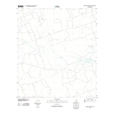
2010 Map of Carrizo Springs NW
USGS Topo · Published 2010About this map
Comanche Creek and Turkey Creek weave through this section of the South Texas brush country, converging near a series of distinctive water bodies. The presence of Crooked Lake, Comanche Lake, and Rocky Lake indicates a riparian landscape where water management and natural catchments define the local geography. A network of rural ranch roads, including Kingsburger Rd, Kalabassa Rd, and Ranch Rd 393, connects the dispersed homesteads and agricultural tracts across this arid terrain. The map's detail reveals the intersection of natural drainage systems like Palo Blanco Creek and Picosa Creek with the human infrastructure required for ranching and local utility, such as the City Landfill Rd in the northeastern corner.
Find a feature on this map
23 named features on this map. Tap any name to fly to it.
Don’t see what you’re looking for? This feature index may not catch every label — zoom into the map to look around manually.
Map Details
Editions of this 2010 Carrizo Springs NW Map
This is the sole edition of this map. No revisions or reprints were ever made.
Other maps of this area

1939 · Carrizo Springs
USGS Topo · 1:62,500

1939 · La Pryor
USGS Topo · 1:62,500

1940 · Cometa
USGS Topo · 1:62,500

1940 · Chacon Creek
USGS Topo · 1:62,500

1953 · Crystal City
USGS Topo · 1:250,000

1955 · Crystal City
USGS Topo · 1:250,000

1958 · Eagle Pass
USGS Topo · 1:250,000

1961 · Crystal City
USGS Topo · 1:250,000

1965 · Eagle Pass
USGS Topo · 1:250,000

1968 · Crystal City
USGS Topo · 1:250,000