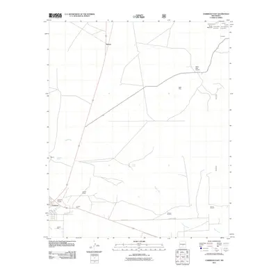
2011 Map of Carrizozo East
USGS Topo · Published 2011About this map
Industrial and mining activities define the landscape surrounding Carrizozo, where the eastern edge of the community meets the foothills of Baxter Mountain. The presence of the Southwest Mineral Corp Mill, Carrizozo Plant, and Lovelace Plant along the southern rail corridor indicates a strong mid-century industrial legacy centered on mineral processing. In the high ground to the northeast, a concentrated cluster of mining claims highlights the region's geological value, featuring sites like Homestake South, Gregory Mine, Annie Cade Mine, and the Collier Mine.
Find a feature on this map
27 named features on this map. Tap any name to fly to it.
Don’t see what you’re looking for? This feature index may not catch every label — zoom into the map to look around manually.
Map Details
Editions of this 2011 Carrizozo East Map
This is the sole edition of this map. No revisions or reprints were ever made.
Other maps of this area

1934 · Capitan
USGS Topo · 1:48,000

1937 · Capitan
USGS Topo · 1:62,500

1938 · Carrizozo
USGS Topo · 1:48,000

1943 · Carrizozo
USGS Topo · 1:62,500

1950 · Carrizozo
USGS Topo · 1:62,500

1950 · Little Black Peak
USGS Topo · 1:62,500

1955 · Roswell
USGS Topo · 1:250,000

1958 · Roswell
USGS Topo · 1:250,000

1962 · Roswell
USGS Topo · 1:250,000
1973 · Nogal
USGS Topo · 1:24,000