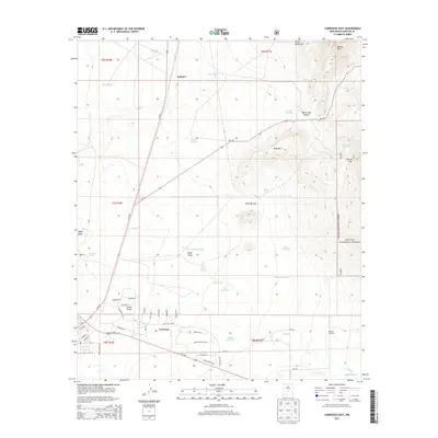
2013 Map of Carrizozo East
USGS Topo · Published 2013About this map
Carrizozo serves as the focal point of this high-desert landscape, where the town grid meets the intersection of Us-54 N and Us-380 E. The terrain rises sharply to the east toward the foothills of the Lincoln National Forest, dominated by the heights of Carrizo Mtn and Baxter Mtn. This geography is defined by its water management, evidenced by numerous historical water sources such as Manchester Spring, Carrizozo Spring, and Fetters Spring.
Find a feature on this map
61 named features on this map. Tap any name to fly to it.
Don’t see what you’re looking for? This feature index may not catch every label — zoom into the map to look around manually.
Map Details
Editions of this 2013 Carrizozo East Map
This is the sole edition of this map. No revisions or reprints were ever made.
Other maps of this area

1934 · Capitan
USGS Topo · 1:48,000

1937 · Capitan
USGS Topo · 1:62,500

1938 · Carrizozo
USGS Topo · 1:48,000

1943 · Carrizozo
USGS Topo · 1:62,500

1950 · Carrizozo
USGS Topo · 1:62,500

1950 · Little Black Peak
USGS Topo · 1:62,500

1955 · Roswell
USGS Topo · 1:250,000

1958 · Roswell
USGS Topo · 1:250,000

1962 · Roswell
USGS Topo · 1:250,000
1973 · Nogal
USGS Topo · 1:24,000