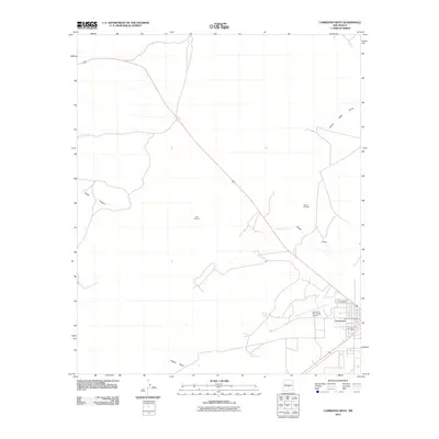
2010 Map of Carrizozo West
USGS Topo · Published 2010About this map
The Malpais dominates the western landscape of this Lincoln County survey, illustrating the stark volcanic terrain that borders the town of Carrizozo. The settlement itself is shown in detail at the southeastern edge of the map, revealing the modern footprint of the Carrizozo Post Office and the Carrizozo Municipal Airport. Evidence of the region's industrial and geological history is scattered throughout, from the L M and M Mill to the Harkey Prospect north of Nogal Draw. The drainage patterns of the high desert are clearly defined by intermittent watercourses like White Oaks Draw and Harkey Draw, while reliable water sources are marked by Anchor Spring and Lower Coyote Spring. This document provides a clear look at the intersection of early 21st-century infrastructure and the enduring, primitive geology of the Tularosa Basin.
Find a feature on this map
15 named features on this map. Tap any name to fly to it.
Don’t see what you’re looking for? This feature index may not catch every label — zoom into the map to look around manually.
Map Details
Editions of this 2010 Carrizozo West Map
This is the sole edition of this map. No revisions or reprints were ever made.
Other maps of this area

1918 · Oscura Peak
USGS Topo · 1:125,000

1938 · Carrizozo
USGS Topo · 1:48,000

1943 · Carrizozo
USGS Topo · 1:62,500

1948 · Broken Back Crater
USGS Topo · 1:62,500

1948 · Chihuahua Ranch
USGS Topo · 1:62,500

1950 · Carrizozo
USGS Topo · 1:62,500

1950 · Little Black Peak
USGS Topo · 1:62,500

1954 · Tularosa
USGS Topo · 1:250,000

1955 · Roswell
USGS Topo · 1:250,000

1958 · Roswell
USGS Topo · 1:250,000