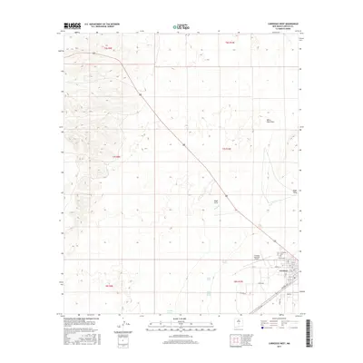
2017 Map of Carrizozo West
USGS Topo · Published 2017About this map
Carrizozo sits at the eastern edge of this landscape, serving as a hub where the grid of town streets meets the open desert terrain of Lincoln County. The town's layout is defined by thoroughfares like Central Ave and Airport St, supporting the local infrastructure around the Carrizozo Municipal Airport. To the west, the land is marked by a network of seasonal watercourses and drainage features, including the prominent White Oaks Draw, Nogal Draw, and Harkey Draw. These ephemeral paths, alongside isolated water sources like Scott Spring and Lower Coyote Spring, illustrate the vital importance of water management in this arid New Mexico environment. The presence of Evergreen Cem on the outskirts of the settlement offers a point of interest for genealogists tracing local families in the region. This survey captures the intersection of organized municipal growth and the expansive, natural drainage systems of the high desert basin.
Find a feature on this map
30 named features on this map. Tap any name to fly to it.
Don’t see what you’re looking for? This feature index may not catch every label — zoom into the map to look around manually.
Map Details
Editions of this 2017 Carrizozo West Map
This is the sole edition of this map. No revisions or reprints were ever made.
Other maps of this area

1918 · Oscura Peak
USGS Topo · 1:125,000

1938 · Carrizozo
USGS Topo · 1:48,000

1943 · Carrizozo
USGS Topo · 1:62,500

1948 · Broken Back Crater
USGS Topo · 1:62,500

1948 · Chihuahua Ranch
USGS Topo · 1:62,500

1950 · Carrizozo
USGS Topo · 1:62,500

1950 · Little Black Peak
USGS Topo · 1:62,500

1954 · Tularosa
USGS Topo · 1:250,000

1955 · Roswell
USGS Topo · 1:250,000

1958 · Roswell
USGS Topo · 1:250,000