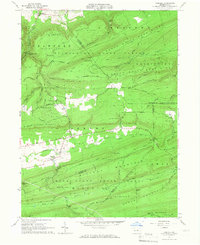
1965 Map of Carroll
USGS Topo · Published 1967About this map
Sugar Valley sits at the heart of this mid-1960s survey, illustrating a remote landscape where settlement is confined to narrow gaps between ridges. The small hamlets of Carroll and Eastville are documented along Fishing Creek, serving as focal points for local rural life. The presence of the Sugar Valley Ch Cem and the Historical Monument near the creek suggests a community with deep roots in this narrow corridor.
Find a feature on this map
88 named features on this map. Tap any name to fly to it.
Don’t see what you’re looking for? This feature index may not catch every label — zoom into the map to look around manually.
Map Details
Editions of this 1965 Carroll Map
4 editions found
Other maps of this area

1921 · Williamsport
USGS Topo · 1:48,000

1921 · Lock Haven
USGS Topo · 1:62,500

1923 · Lock Haven
USGS Topo · 1:62,500

1923 · Williamsport
USGS Topo · 1:62,500

1937 · Millheim
USGS Topo · 1:48,000

1938 · Mifflinburg
USGS Topo · 1:48,000

1941 · Millheim
USGS Topo · 1:62,500

1943 · Mifflinburg
USGS Topo · 1:62,500

1944 · Williamsport
USGS Topo · 1:62,500

1944 · Lock Haven
USGS Topo · 1:62,500
Featured Places
- Lewis Township, PA
- Limestone Township, PA
- Hartley Township, PA
- Eastville, Greene Township
- Crawford Township, PA