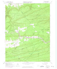
1965 Map of Carroll
USGS Topo · Published 1974About this map
Sugar Valley forms the heart of this central Pennsylvania landscape, where the settlements of Carroll and Eastville are situated along the banks of Fishing Creek. The map documents a rural corridor transitioning into heavy forest, with the valley floor dominated by small farm plots while the surrounding ridges of Sugar Valley Mountain and Nittany Mountain remain protected within the Tiadaghton State Forest and Bald Eagle State Forest. A unique hydrological feature, the Creek Sinks, illustrates the limestone-rich geology of the region.
Find a feature on this map
63 named features on this map. Tap any name to fly to it.
Don’t see what you’re looking for? This feature index may not catch every label — zoom into the map to look around manually.
Map Details
Editions of this 1965 Carroll Map
4 editions found
Other maps of this area

1921 · Williamsport
USGS Topo · 1:48,000

1921 · Lock Haven
USGS Topo · 1:62,500

1923 · Lock Haven
USGS Topo · 1:62,500

1923 · Williamsport
USGS Topo · 1:62,500

1937 · Millheim
USGS Topo · 1:48,000

1938 · Mifflinburg
USGS Topo · 1:48,000

1941 · Millheim
USGS Topo · 1:62,500

1943 · Mifflinburg
USGS Topo · 1:62,500

1944 · Williamsport
USGS Topo · 1:62,500

1944 · Lock Haven
USGS Topo · 1:62,500
Featured Places
- Lewis Township, PA
- Limestone Township, PA
- Hartley Township, PA
- Eastville, Greene Township
- Crawford Township, PA