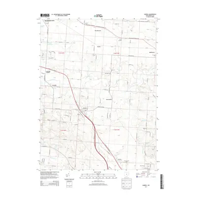
2013 Map of Carroll
USGS Topo · Published 2013About this map
Carroll and the surrounding Fairfield County landscape reveal a classic Midwestern arrangement of township sections and small rail-centered settlements. The Columbus Lancaster Rd NW serves as a primary corridor, cutting through the terrain between Pickerington and the village of Baltimore. Local history is anchored by several rural burial grounds, including Betzer Cem and the nearby Old Betzer Cem, alongside Fairview Cem and Bickel Cem.
Find a feature on this map
135 named features on this map. Tap any name to fly to it.
Don’t see what you’re looking for? This feature index may not catch every label — zoom into the map to look around manually.
Map Details
Editions of this 2013 Carroll Map
This is the sole edition of this map. No revisions or reprints were ever made.
Other maps of this area

1907 · Lancaster
USGS Topo · 1:62,500

1907 · Thurston
USGS Topo · 1:62,500

1909 · Lancaster
USGS Topo · 1:62,500

1909 · Thurston
USGS Topo · 1:62,500

1914 · Circleville
USGS Topo · 1:62,500

1925 · East Columbus
USGS Topo · 1:62,500

1943 · Circleville
USGS Topo · 1:62,500

1943 · East Columbus
USGS Topo · 1:62,500

1947 · Columbus
USGS Topo · 1:250,000
1955 · Canal Winchester
USGS Topo · 1:24,000