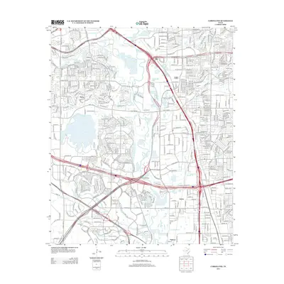
2012 Map of Carrollton
USGS Topo · Published 2012About this map
Trinity Mills and Gribble sit at the intersection of a massive transportation network in this 2012 survey, where the N Stemmons Fwy and President George Bush Tpke E converge. The landscape is defined by the winding course of the Elm Fork Trinity River, which is fed by numerous tributaries including Denton Cr and Hackberry Cr. This era shows a densely developed suburban corridor, yet it retains connections to its earlier history through landmarks like Harrington Cem and Hilltop Memorial Park. Educational and community hubs are prominent, with the Dallas Christian Coll and Southeastern Career Institute serving the growing population. The proximity of N Lake and several smaller branches like Farmers Br and Cooks Br highlights how modern infrastructure has been integrated into the natural hydrology of the river basin.
Find a feature on this map
43 named features on this map. Tap any name to fly to it.
Don’t see what you’re looking for? This feature index may not catch every label — zoom into the map to look around manually.
Map Details
Editions of this 2012 Carrollton Map
This is the sole edition of this map. No revisions or reprints were ever made.
Other maps of this area

1891 · Dallas
USGS Topo · 1:125,000

1893 · Dallas
USGS Topo · 1:125,000

1894 · Fort Worth
USGS Topo · 1:125,000

1925 · Mc Kinney 3-c
USGS Topo · 1:48,000

1925 · Dallas 2-b
USGS Topo · 1:48,000

1929 · Frisco
USGS Topo · 1:62,500

1931 · Carrollton
USGS Topo · 1:62,500

1931 · Grapevine
USGS Topo · 1:62,500

1954 · Dallas
USGS Topo · 1:250,000

1954 · Sherman
USGS Topo · 1:250,000