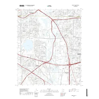
2019 Map of Carrollton
USGS Topo · Published 2019About this map
The Elm Fork Trinity River carves a central path through this highly developed landscape where the borders of Carrollton, Lewisville, and Irving converge. This survey reflects the dense infrastructure of the late 2010s, dominated by major transportation arteries like the S Stemmons Fwy and the President George Bush Tpke. Despite the urban expansion, several historical anchors remain visible, including Trinity Mills and the smaller settlement of Gribble.
Find a feature on this map
45 named features on this map. Tap any name to fly to it.
Don’t see what you’re looking for? This feature index may not catch every label — zoom into the map to look around manually.
Map Details
Editions of this 2019 Carrollton Map
This is the sole edition of this map. No revisions or reprints were ever made.
Other maps of this area

1891 · Dallas
USGS Topo · 1:125,000

1893 · Dallas
USGS Topo · 1:125,000

1894 · Fort Worth
USGS Topo · 1:125,000

1925 · Mc Kinney 3-c
USGS Topo · 1:48,000

1925 · Dallas 2-b
USGS Topo · 1:48,000

1929 · Frisco
USGS Topo · 1:62,500

1931 · Carrollton
USGS Topo · 1:62,500

1931 · Grapevine
USGS Topo · 1:62,500

1954 · Dallas
USGS Topo · 1:250,000

1954 · Sherman
USGS Topo · 1:250,000