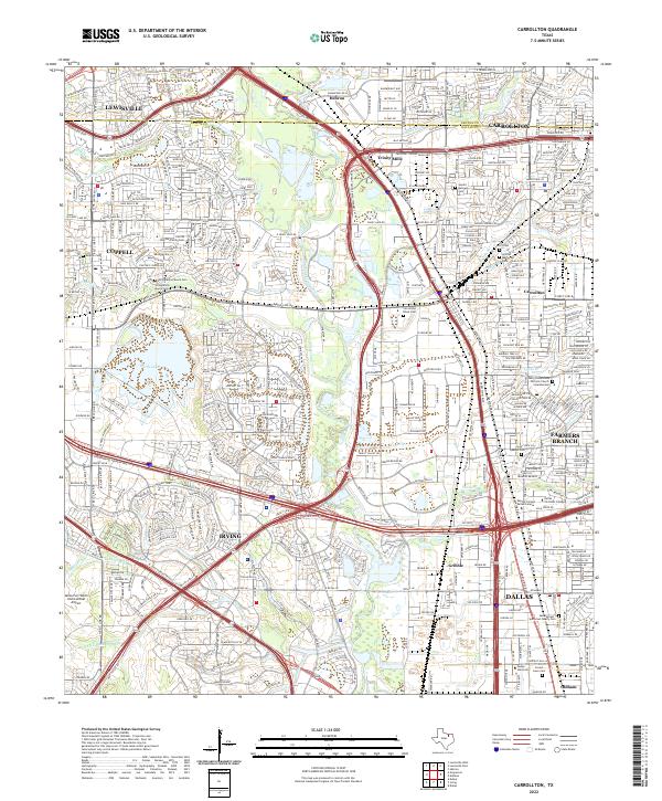
2022 Map of Carrollton
USGS Topo · Published 2022About this map
Carrollton and the surrounding North Texas communities of Farmers Branch, Coppell, and Irving are defined by a complex network of modern expressways and natural waterways. The Elm Fork Trinity River winds through the center of the landscape, bordered by recreation areas like Sandy Lake and the industrial corridors of Gribble and Trinity Mills. This modern survey reveals how the suburban expansion of Dallas has integrated historic sites into its fabric, preserving several small family burial grounds amidst residential developments.
Find a feature on this map
55 named features on this map. Tap any name to fly to it.
Don’t see what you’re looking for? This feature index may not catch every label — zoom into the map to look around manually.
Map Details
Editions of this 2022 Carrollton Map
This is the sole edition of this map. No revisions or reprints were ever made.
Historical Maps of Trinity Mills Through Time
4 maps found