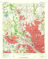
1959 Map of Carrollton
USGS Topo · Published 1963About this map
The Elm Fork Trinity River flows through a landscape transitioning from rural agrarian roots to postwar suburban expansion. This survey illustrates the rapid growth of the Dallas metroplex, where newer residential developments in University Park and Highland Park contrast with older outlying settlements like Trinity Mills and Gribble. Aviation plays a central role in this geography, anchored by the sprawling Love Field Municipal Airport and supported by smaller facilities such as the Park Cities Airfield and the Jap Lee Airstrip.
Find a feature on this map
144 named features on this map. Tap any name to fly to it.
Don’t see what you’re looking for? This feature index may not catch every label — zoom into the map to look around manually.
Map Details
Editions of this 1959 Carrollton Map
This is the sole edition of this map. No revisions or reprints were ever made.
Other maps of this area

1891 · Dallas
USGS Topo · 1:125,000

1893 · Dallas
USGS Topo · 1:125,000

1894 · Fort Worth
USGS Topo · 1:125,000

1925 · Mc Kinney 3-c
USGS Topo · 1:48,000

1925 · Dallas 2-b
USGS Topo · 1:48,000

1929 · Frisco
USGS Topo · 1:62,500

1929 · McKinney
USGS Topo · 1:62,500

1931 · Carrollton
USGS Topo · 1:62,500

1931 · Grapevine
USGS Topo · 1:62,500

1954 · Dallas
USGS Topo · 1:250,000