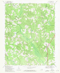
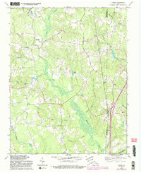
1969 Map of Carson
USGS Topo · Published 1971About this map
Carson serves as a central hub on this Virginia landscape, positioned along the Seaboard Coast Line railroad where it meets the boundary of Dinwiddie and Prince George counties. The map captures a region defined by extensive wetland networks, with Arthur Swamp and Rowanty Creek dominating the drainage patterns. These water features dictate the placement of early routes like Halifax Road and New Stage Road, which skirt the lower-lying terrain.
Find a feature on this map
36 named features on this map. Tap any name to fly to it.
Don’t see what you’re looking for? This feature index may not catch every label — zoom into the map to look around manually.
Map Details
Editions of this 1969 Carson Map
5 editions found
Other maps of this area

1894 · Petersburg
USGS Topo · 1:62,500

1897 · Amelia
USGS Topo · 1:125,000

1919 · Jarratt
USGS Topo · 1:62,500

1919 · Mc Kenney
USGS Topo · 1:48,000

1921 · Mc Kenney
USGS Topo · 1:62,500

1943 · Mc Kenney
USGS Topo · 1:62,500

1943 · Dinwiddie
USGS Topo · 1:24,000

1943 · Sutherland
USGS Topo · 1:24,000

1943 · Richmond
USGS Topo · 1:250,000

1944 · Reams
USGS Topo · 1:31,680