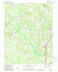
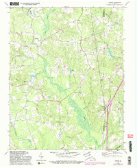
1969 Map of Carson
USGS Topo · Published 1987About this map
Rowanty Creek and its many tributaries, including Hatcher Run and Gravelly Run, define the low-lying landscape south of Petersburg during the late 1960s. The settlement of Carson serves as a local hub near the CSX rail line, featuring the Carson School and various rural infrastructure. This area at the border of Dinwiddie and Prince George counties is dotted with numerous small congregations such as Tabernacle Church, Shiloh Church, and Little Zion Church. A notable piece of Civil War history is preserved at the Confederate Cemetery near the southern boundary. The presence of Perkins Pond and Bodies Pond amidst the expansive Warren Swamp highlights the importance of water management and local drainage in this agricultural and timber region. Modern transit is also visible as the interstate system carves through the eastern portion of the quadrangle at Interchange 11.
Find a feature on this map
38 named features on this map. Tap any name to fly to it.
Don’t see what you’re looking for? This feature index may not catch every label — zoom into the map to look around manually.
Map Details
Editions of this 1969 Carson Map
5 editions found
Other maps of this area

1894 · Petersburg
USGS Topo · 1:62,500

1897 · Amelia
USGS Topo · 1:125,000

1919 · Jarratt
USGS Topo · 1:62,500

1919 · Mc Kenney
USGS Topo · 1:48,000

1921 · Mc Kenney
USGS Topo · 1:62,500

1943 · Mc Kenney
USGS Topo · 1:62,500

1943 · Dinwiddie
USGS Topo · 1:24,000

1943 · Sutherland
USGS Topo · 1:24,000

1943 · Richmond
USGS Topo · 1:250,000

1944 · Reams
USGS Topo · 1:31,680