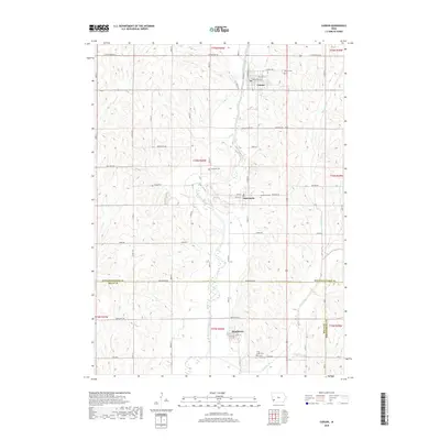
2018 Map of Carson
USGS Topo · Published 2018About this map
The West Nishnabotna River snakes through the heart of this agricultural region, anchoring a series of river-valley settlements from Carson in the north down to Macedonia and Henderson. This corridor preserves significant historical pathways, most notably the Iowa Mormon Trl and Pioneer Trl, which cut across the township lines of t75n r40w and t74n r40w. These routes trace the migration patterns that shaped southwestern Iowa's early development.
Find a feature on this map
39 named features on this map. Tap any name to fly to it.
Don’t see what you’re looking for? This feature index may not catch every label — zoom into the map to look around manually.
Map Details
Editions of this 2018 Carson Map
This is the sole edition of this map. No revisions or reprints were ever made.
Other maps of this area

1954 · Omaha
USGS Topo · 1:250,000

1956 · Treynor
USGS Topo · 1:24,000

1956 · Malvern
USGS Topo · 1:24,000

1957 · Omaha
USGS Topo · 1:250,000

1957 · Taylor
USGS Topo · 1:24,000

1958 · Omaha
USGS Topo · 1:250,000

1963 · Avoca SE
USGS Topo · 1:24,000

1963 · Oakland
USGS Topo · 1:24,000

1978 · Carson
USGS Topo · 1:24,000
1978 · Emerson
USGS Topo · 1:24,000