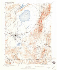
1908 Map of Carson Sink
USGS Topo · Published 1959About this map
Fallon serves as the central hub of this Great Basin landscape, where the waters of the Carson River meet the vast desert expanse. In the early twentieth century, this region was a critical corridor for both natural waterways and the expanding rail networks of the Southern Pacific System and the Nevada and California RR. The map illustrates a complex hydraulic environment, featuring the Carson Sink, Humboldt Lake, and several smaller bodies like Soda Lake and Carson Lake.
Find a feature on this map
102 named features on this map. Tap any name to fly to it.
Don’t see what you’re looking for? This feature index may not catch every label — zoom into the map to look around manually.
Map Details
Editions of this 1908 Carson Sink Map
3 editions found

Other maps of this area

1886 · Granite Range
USGS Topo · 1:250,000

1890 · Wadsworth
USGS Topo · 1:125,000

1891 · Wabuska
USGS Topo · 1:125,000

1891 · Wellington
USGS Topo · 1:125,000

1892 · Wadsworth
USGS Topo · 1:125,000

1893 · Wellington
USGS Topo · 1:125,000

1894 · Granite Range
USGS Topo · 1:250,000

1894 · Wadsworth
USGS Topo · 1:125,000

1894 · Wabuska
USGS Topo · 1:125,000

1907 · Tonopah
USGS Topo · 1:250,000