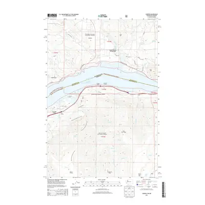
2014 Map of Carson
USGS Topo · Published 2014About this map
Saint Martins Hot Springs and the settlement of Carson anchor the northern shore of the Columbia River, where the Wind River flows into the gorge from the Gifford Pinchot National Forest. This 2014 survey documents the complex transportation and industrial corridor between Washington and Oregon, featuring the Lewis and Clark Hwy and State Hwy 14 alongside the river's Wind Mountain Lower Range Channel.
Find a feature on this map
68 named features on this map. Tap any name to fly to it.
Don’t see what you’re looking for? This feature index may not catch every label — zoom into the map to look around manually.
Map Details
Editions of this 2014 Carson Map
This is the sole edition of this map. No revisions or reprints were ever made.
Other maps of this area

1926 · Hood River
USGS Topo · 1:125,000

1929 · Hood River
USGS Topo · 1:125,000

1953 · The Dalles
USGS Topo · 1:250,000

1956 · The Dalles
USGS Topo · 1:250,000

1957 · The Dalles
USGS Topo · 1:250,000

1957 · Bonneville Dam
USGS Topo · 1:62,500

1957 · Wind River
USGS Topo · 1:62,500

1957 · Willard
USGS Topo · 1:62,500

1957 · Hood River
USGS Topo · 1:62,500
1979 · Bonneville Dam
USGS Topo · 1:24,000