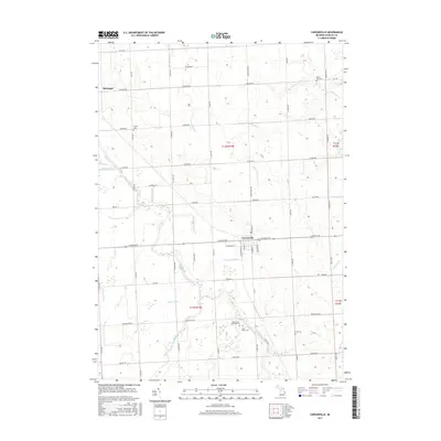
2017 Map of Carsonville
USGS Topo · Published 2017About this map
Carsonville serves as the primary hub of this agricultural landscape in eastern Sanilac County, where the street grid of W Sheldon St and E Chandler St meets the rural crossing of E Sanilac Rd. The surrounding terrain is defined by a dense network of drainage systems and natural waterways, including the winding Black River and the complex McDonald Drain and Shrapnell Drain systems that support the local farmland. Genealogists will find significant value in the distribution of family and community burial grounds, such as Washington Township Cem and Saint Marys Cem located south of the main settlement. Further north, the small community of McGregor marks the intersection of Ruth Rd and Forester Rd, while the eastern portion of the survey is drained by Sherman Cr and Forester Cr as they flow toward the nearby lake shore.
Find a feature on this map
60 named features on this map. Tap any name to fly to it.
Don’t see what you’re looking for? This feature index may not catch every label — zoom into the map to look around manually.
Map Details
Editions of this 2017 Carsonville Map
This is the sole edition of this map. No revisions or reprints were ever made.
Other maps of this area

1954 · Flint
USGS Topo · 1:250,000

1958 · Flint
USGS Topo · 1:250,000

1963 · Sandusky
USGS Topo · 1:24,000

1963 · Peck
USGS Topo · 1:24,000

1963 · Croswell
USGS Topo · 1:24,000

1963 · Port Sanilac
USGS Topo · 1:24,000

1963 · Palms
USGS Topo · 1:24,000

1963 · Applegate
USGS Topo · 1:24,000

1963 · Deckerville
USGS Topo · 1:24,000

1963 · Richmondville
USGS Topo · 1:24,000
Featured Places
- Carsonville, MI
- Washington Township, MI
- Forester Township, MI
- Watertown Township, MI
- Bridgehampton Township, MI