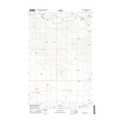
2017 Map of Carter Coulee
USGS Topo · Published 2017About this map
The Missouri River winds across the northern reaches of this landscape, carving a series of fertile lowlands including Bell Bottoms, White Bottoms, and Mauland Bottoms near the border of Phillips and Fergus counties. These alluvial flats are set against a backdrop of complex terrain, where the high Mc Farland Bench and Elevator Ridge overlook a network of deep drainages. The area is defined by its many namesake coulees, from Carter Coulee and Fritzner Coulee in the north to Musselman Coulee further south.
Find a feature on this map
38 named features on this map. Tap any name to fly to it.
Don’t see what you’re looking for? This feature index may not catch every label — zoom into the map to look around manually.
Map Details
Editions of this 2017 Carter Coulee Map
This is the sole edition of this map. No revisions or reprints were ever made.
Other maps of this area

1943 · Landusky
USGS Topo · 1:125,000

1954 · Bell Ridge East
USGS Topo · 1:24,000

1954 · Hessler Ridge
USGS Topo · 1:24,000

1954 · Carter Coulee
USGS Topo · 1:24,000

1954 · Bell Ridge West
USGS Topo · 1:24,000

1954 · Lewistown
USGS Topo · 1:250,000

1959 · Lewistown
USGS Topo · 1:250,000

1971 · Kepple Bottoms
USGS Topo · 1:24,000
1971 · Sagebrush Reservoir
USGS Topo · 1:24,000

1984 · Zortman
USGS Topo · 1:100,000