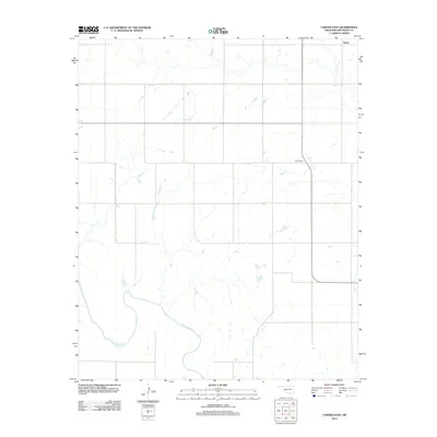
2012 Map of Carter East
USGS Topo · Published 2012About this map
The N Fork Red River meanders across the southwestern corner of this Beckham County landscape, defining the local topography in a region otherwise characterized by a regular grid of section lines and rural homesteads. This 2012 survey from the U.S. Geological Survey documents the agricultural layout of the plains just as the century turned. Genealogists and local historians can locate Poarch Cem along the primary north-south route, providing a specific point of reference for families tied to this part of Oklahoma. In the northeastern corner, the settlement of Taylor sits near the map's edge, serving as a landmark for the community that developed around these vital water sources and transportation corridors.
Find a feature on this map
3 named features on this map. Tap any name to fly to it.
Don’t see what you’re looking for? This feature index may not catch every label — zoom into the map to look around manually.
Map Details
Editions of this 2012 Carter East Map
This is the sole edition of this map. No revisions or reprints were ever made.
Other maps of this area

1955 · Clinton
USGS Topo · 1:250,000

1957 · Clinton
USGS Topo · 1:250,000

1960 · Sayre
USGS Topo · 1:62,500

1961 · Willow
USGS Topo · 1:62,500

1961 · Retrop
USGS Topo · 1:62,500

1961 · Elk City
USGS Topo · 1:62,500

1985 · Elk City
USGS Topo · 1:100,000
1987 · Hocker
USGS Topo · 1:24,000
1987 · Elk City SE
USGS Topo · 1:24,000
1989 · Willow
USGS Topo · 1:24,000