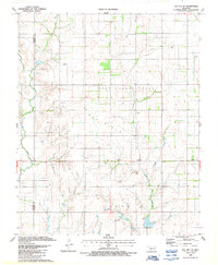
1987 Map of Elk City SE
USGS Topo · Published 1987About this map
West Turkey Creek and Elk Creek define the drainage patterns of this rural landscape along the boundary of Beckham and Washita Counties. The area is characterized by a significant Gas Field infrastructure, with numerous extraction points such as a Gas Well and associated pipelines marking the hillsides. Local community life centers around historic rural congregations including Hefner Ch and Elk Creek Ch, which stand as landmarks for genealogists tracing family ties in western Oklahoma. The small settlement of Forty One occupies a central position, while modern communications are evidenced by the Radio Facility and Radio Tower located in the eastern portion of the quadrangle. The map captures the intersection of traditional agricultural land use and the late 20th-century energy industry.
Find a feature on this map
12 named features on this map. Tap any name to fly to it.
Don’t see what you’re looking for? This feature index may not catch every label — zoom into the map to look around manually.
Map Details
Editions of this 1987 Elk City SE Map
This is the sole edition of this map. No revisions or reprints were ever made.
Other maps of this area

1955 · Clinton
USGS Topo · 1:250,000

1957 · Clinton
USGS Topo · 1:250,000

1957 · Dill City
USGS Topo · 1:62,500

1961 · Hobart
USGS Topo · 1:62,500

1961 · Retrop
USGS Topo · 1:62,500

1961 · Elk City
USGS Topo · 1:62,500

1976 · Dill City NE
USGS Topo · 1:24,000
1983 · Foss
USGS Topo · 1:24,000

1983 · Dill City
USGS Topo · 1:24,000

1984 · Sentinel
USGS Topo · 1:24,000