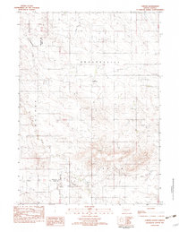
1982 Map of Carter
USGS Topo · Published 1982About this map
The small settlement of Carter sits at the intersection of Tripp, Mellette, and Todd counties, serving as a quiet focal point in this south-central South Dakota landscape during the early 1980s. This survey records a transition in regional infrastructure, notably the presence of a Dismantled RR cutting across the northern half of the quadrangle. The terrain is defined by the elevation of the Red Hills and the winding paths of McChesneys Creek and De Bell Creek. Evidence of local industry and aviation appears through several Gravel Pits and the Schlakker Landing Strip. A portion of the Rosebud Indian Res occupies the western edge, while the northern section includes the Progressive township area, illustrating the intersection of tribal lands, county boundaries, and rural agricultural development.
Find a feature on this map
14 named features on this map. Tap any name to fly to it.
Don’t see what you’re looking for? This feature index may not catch every label — zoom into the map to look around manually.
Map Details
Editions of this 1982 Carter Map
This is the sole edition of this map. No revisions or reprints were ever made.
Other maps of this area

1955 · Martin
USGS Topo · 1:250,000

1958 · Martin
USGS Topo · 1:250,000

1982 · Presho 4 SE
USGS Topo · 1:25,000

1982 · Witten SE
USGS Topo · 1:25,000

1982 · Two Nation Creek
USGS Topo · 1:25,000

1982 · Badnation SE
USGS Topo · 1:25,000

1982 · Witten
USGS Topo · 1:25,000

1982 · Witten SW
USGS Topo · 1:25,000

1982 · Okreek SE
USGS Topo · 1:24,000

1982 · Mosher
USGS Topo · 1:25,000